File:מחנה יהודה.JPG

Original file (5,184 × 3,456 pixels, file size: 7.3 MB, MIME type: image/jpeg)
Captions
Captions
Summary[edit]
| Description |
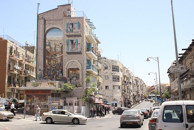
English: Jerusalem, Mahane Yehuda neighborough, corner of Eliyahu Mani & HaRav Shmuel Baruch
עברית: ירושלים גם ידוע כאריאל וגם כן שיכות לשבט יהודה שסימנו אריה.
אריה הוא סמל הנצחי ירושלים. בצלום ציור ריאליסטי נושאי שוק "המחנה יהודה" זה מראה את פרטיו של אריה. אוסף צילומים של האריות מירושלים http://leonesdejerusalem.tumblr.com/Español: Jerusalem también es conocida como "Ariel" (León de Dios) y
pertenece a la tribu de Yehuda que su símbolo es el León. El león es un símbolo eterno en Jerusalem. En la Fotografía, pintura realista con tema del mercado "Mahane Yehuda" en ella se muestra el detalle de un León. De la colección fotográfica de los leones de Jerusalem. http://leonesdejerusalem.tumblr.com/English: Jerusalem is also known as "Ariel" (Lion of God) and
belongs to the tribe of Judah that his symbol is the lion. The lion is a constant symbol in Jerusalem. In photography, realistic painting themed Market "Mahane Yehuda" it shows the detail of a Lion. Photographic Collection Jerusalem Lions. http://leonesdejerusalem.tumblr.com/
|
||
| Date | |||
| Source | Own work | ||
| Author | Ladymantequilla |
| Camera location | | View this and other nearby images on: OpenStreetMap |
|---|
|
The reproduction of this architectural work, work of sculpture or work of applied art, is covered under the Israeli copyright statute (2007), which states that "Broadcasting, or copying by way of photography, drawing, sketch or similar visual description, of an architectural work, a work of sculpture or work of applied art, are permitted where the aforesaid work is permanently situated in a public place." (paragraph 23)
See COM:CRT/Israel#Freedom of panorama and COM:CRT/Israel#De minimis for more information.
|
Licensing[edit]
- You are free:
- to share – to copy, distribute and transmit the work
- to remix – to adapt the work
- Under the following conditions:
- attribution – You must give appropriate credit, provide a link to the license, and indicate if changes were made. You may do so in any reasonable manner, but not in any way that suggests the licensor endorses you or your use.
- share alike – If you remix, transform, or build upon the material, you must distribute your contributions under the same or compatible license as the original.

|
This image was uploaded as part of Wiki Loves Monuments 2012.
|
 |
| Annotations | This image is annotated: View the annotations at Commons |

.JPG)
File history
Click on a date/time to view the file as it appeared at that time.
| Date/Time | Thumbnail | Dimensions | User | Comment | |
|---|---|---|---|---|---|
| current | 20:35, 14 October 2012 | | 5,184 × 3,456 (7.3 MB) | Ladymantequilla (talk | contribs) | User created page with UploadWizard |
You cannot overwrite this file.
File usage on Commons
There are no pages that use this file.
File usage on other wikis
The following other wikis use this file:
- Usage on he.wikiquote.org