This copy is copyright protected.
Copyright © 2024 Geographicus Rare Antique Maps
1948 Szapiro Map of the 1948 Arab - Israeli War in Hebrew
WarringIsrael-szapiro-1948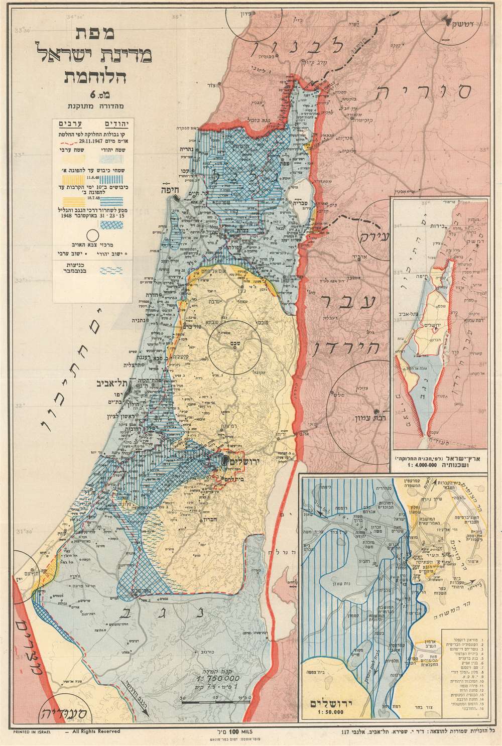

Copyright © 2024 Geographicus Rare Antique Maps | Geographicus Rare Antique Maps
This copy is copyright protected.
Copyright © 2024 Geographicus Rare Antique Maps