

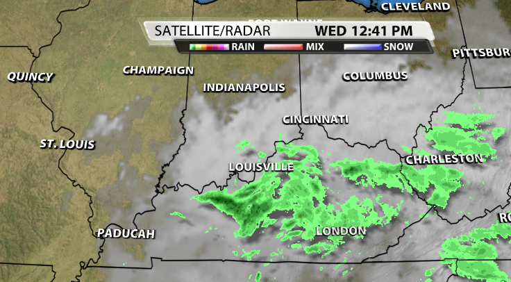


When you pull up the radar today on the WDRB Weather App, you may see something like this where it looks like a lot of rain is on top of us.

Then you step outside and don't really feel anything falling, or you just feel a few sprinkles. This has probably happened to many of you today because of what is called virga.

Virga is another fancy weather term you may hear the WDRB Weather Team use on TV. This isn't uncommon and happens pretty frequently, but still the atmospheric conditions need to be right for it to happen.
What is Virga?
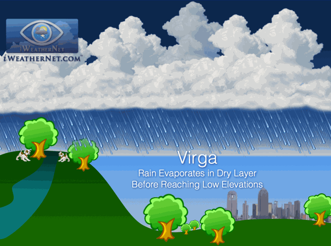
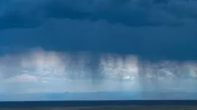
So...what is Virga? The National Weather Service classifies virga as "Streaks or wisps of precipitation falling from a cloud but evaporating before reaching the ground." So, basically, it's rain that is falling from a cloud that is not making it all the way to the surface because it's evaporating from dry air.
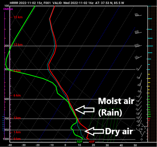
Many of us have seen this occur today. When Meteorologists look at an atmospheric sounding (a 2D plot of the atmosphere from top to bottom), we can see the amount of dry air above our heads, and know that even though the radar is showing rain falling from the cloud, a lot of that isn't actually making it to the surface.

Another way that Virga may occur in more locations with changes in height would be where higher elevations may get actual rainfall while lower locations wouldn't in the same area.

Image Courtesy of IWeatherNet
Why does radar still show rain?
If Virga is rain that is evaporating due to dry air before it actually reaches the ground, then why does the radar still show rain on it? The simple reason is the fact that radars are actually tilted upward some into the sky. Meaning, that the further away from the actual radar that the Virga, or any form of precipitation is happening, the higher into the sky and cloud that radar beam is looking.

Image Courtesy of Government of Canada
This is also why you may hear us say on TV that when there is rotation within a storm, it could be more rotation higher above the ground more-so than actually at the surface because that location may be further away from the radar, meaning that we're actually looking up high into the cloud from that radar beam.


